The river of Gialia or Idalia is the second biggest river in Cyprus, after Pedieos and the distance that it covers from its sources until the gulf of Ammochostos where it flows into the sea, exceeds 88 kilometres.
The river waters start their journey from the southeast slopes of the “Kionia” mountains, a few kilometres, a few kilometres higher of the Machairas monastery. During rainy seasons it is transformed into a wild and dangerous torrent, since it has killed people at its path.
The river’s direction goes north of the Lythrodontas and Mathiatis villages, and after it fills three small, consecutive dams it goes to the Kotsiatis village. After it passes this village from the east, it continues and passes under the motorway of Nicosia to Limassol, where the villages Nisou on the north and Pera Chorio on the south are found.
At this point, a strange geological phenomenon takes place. The river water is absorbed by the huge, natural galleries that are there, thus enriching the aquifers of an area of many kilometres. In the area, any constructive activity is prohibited because of the existing danger of disasters.
When the river fills the needs of the aquifers, it continues its journey and it is divides the Dali municipality into two parts. Consequently it passes west of the Potamia village and east of the Agios Sozomenos abandoned village.
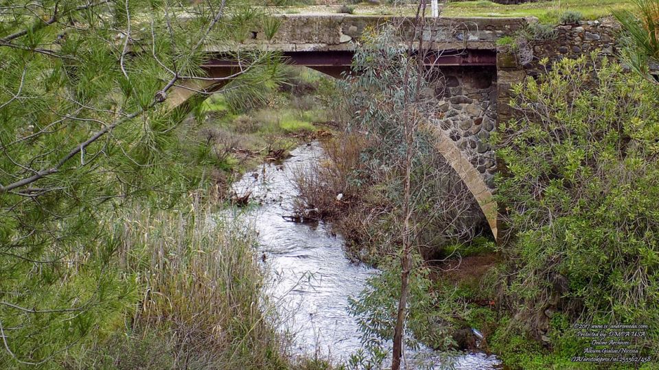
But it does not stop here. It carries on and enters the occupied plains of Mesaoria and after it waters its fields, it flows into the sea of Ammochostos. There are many parts of the river that can be studied and observed on this 88 kilometre journey. A very good point is the old bridge that is found on the north side of the Lythrodontas village.
Always remember that the rivers in Cyprus, turn into wild torrents during the winter, that make them very dangerous. Do not descend too low on their beds.